P1 — Autonomous Vacuum Cleaner
Autonomous Navigation for a Vacuum Robot
In this blog, I present the implementation of a Grid-Based Planning & Navigation Algorithm for a vacuum robot. This system allows the robot to explore and clean an area efficiently, avoiding obstacles and optimizing surface coverage.
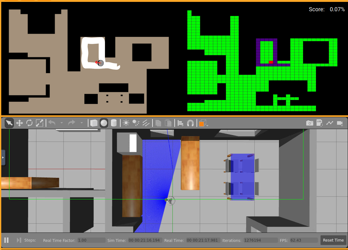
Strategy
The algorithm combines several techniques:
- Obstacle Inflation 🚧: Increases the perceived size of obstacles to ensure the robot does not collide.
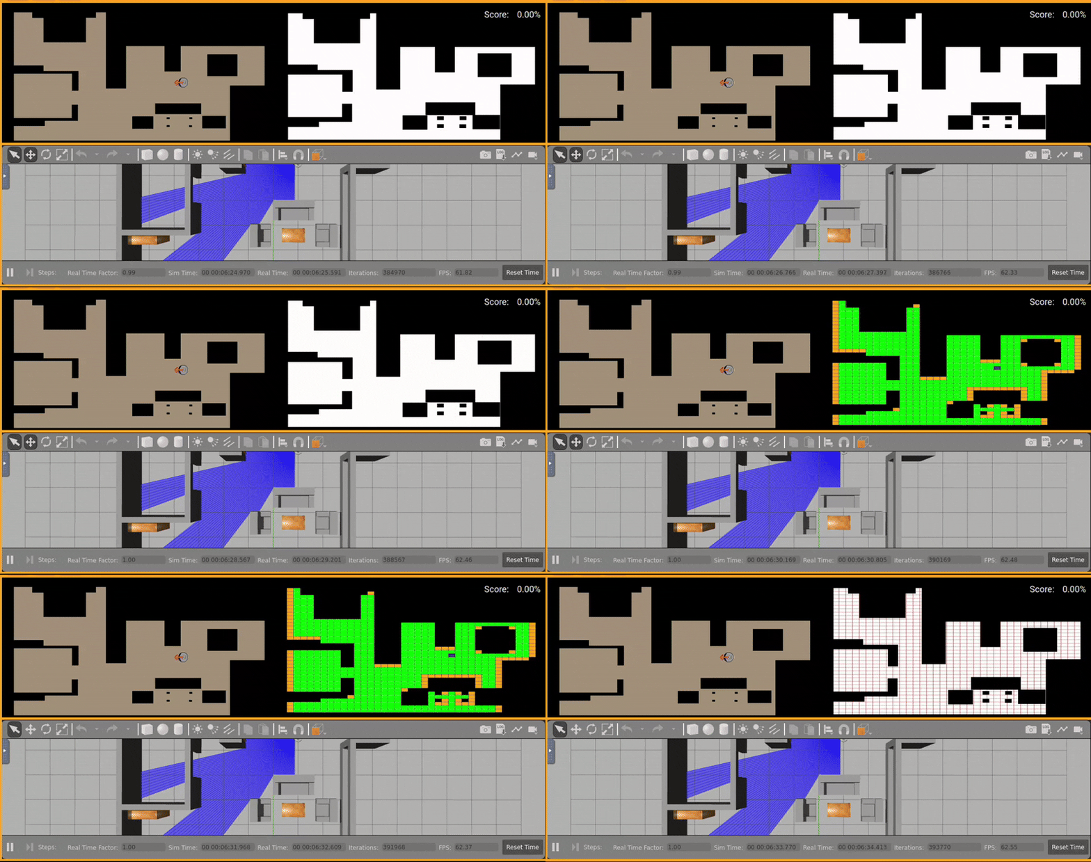
- Grid Creation: The map is divided into cells classified by their state (free, occupied, obstacle, critical, or return).
- Grid-Based Planning: A movement plan is generated from the starting cell to cover all accessible areas.
- Robot Control: A proportional controller adjusts linear and angular velocity to follow the plan smoothly.
- Initial Direction Selection: Based on laser data, the robot decides its initial orientation toward the area with the most free space.
Map Preparation
1. Obstacle Inflation
The map is inflated to increase obstacle size considering the robot’s radius, ensuring it does not get too close to walls or furniture.
2. NumPy Conversion
The map is converted into a NumPy array for easier processing, representing free and occupied cells with discrete values.
3. Grid Creation
The grid divides the map into cells roughly the size of the robot’s diameter. Each cell is classified as:
- FREE: Accessible cell.
- OBSTACLE: Cell occupied by an obstacle.
- CLOSED: Partially accessible cell.
- OCCUPIED: Already visited cell.
- CRITICAL: Currently targeted cell.
- RETURNED: Return cell to follow unexplored paths.
Each cell stores its center in pixels and its state, facilitating planning and visualization.
Motion Planning
1. Selecting the Initial Cell
The robot’s current cell is identified using its world coordinates and a map-to-pixels transformation function.
2. Priority and Exploration Order
The algorithm explores neighboring cells following a Dynamic Priority Order adjustable in real time. By default, it may follow West → North → East → South, but it can be modified depending on the environment or user preferences.
Each visited cell is marked as OCCUPIED. This dynamic priority is passed directly to the planificate_grid function, allowing the robot to change its exploration strategy based on specific needs or sensor data.
3. Searching for the Nearest Free Cell
If the robot gets stuck, BFS (Breadth-First Search) is used to find the nearest free cell. This ensures the robot continues exploring the entire area without getting trapped.
4. Plan Generation
The final plan consists of a list of cells the robot must visit, prioritizing full coverage while avoiding obstacles.
Robot Control
The robot adjusts its linear & angular velocity using a proportional controller that considers:
- Distance to the target.
- Angular error between the robot’s orientation and the target cell direction.
- Alignment of upcoming cells to smooth or accelerate movement.
- Speed reduction when approaching the target cell.
Maximum speed is limited for safety, and adjustment factors are applied to keep the robot aligned with the planned trajectory.
Initial Direction Based on Laser
Before starting, the laser data is analyzed to select the initial direction with the most free space. This avoids unnecessary movement toward blocked areas at the beginning of the route.
Robot States 🤖
The algorithm defines three main states:
- PLANIFICATE 🗺️: Generates the exploration plan based on the grid.
- TRAVEL_IT 🚶: Robot follows the plan visiting cells.
- FINISHED ✅: All accessible cells have been explored.
- TEST 🧪: Allows visual verification of the grid and the robot’s current position without moving.
Visualization and Monitoring
The grid and map are visualized in real time using WebGUI, with different colors according to each cell’s state:
- Black: Obstacle
- Green: Free
- Indigo: Occupied
- Red: Critical
- Violet: Return
- Orange: Default/Closed
This enables intuitive monitoring of the robot’s planning and progress.
.gif)
Videos
- Autonomous Cleaner 🤖:
Conclusion
This grid-based navigation system allows a vacuum robot to:
- Explore complex areas autonomously.
- Avoid obstacles and minimize collisions.
- Efficiently cover the entire map surface.
Thanks to the combination of Obstacle Inflation 🚧, Grid Planning 🟩, BFS for Alternative Routes 🔍, and a Proportional Controller ⚙️, the robot achieves full and safe autonomous cleaning. This approach is scalable and can adapt to different environments by simply adjusting the grid size and the robot’s radius.